TEL: 07979 812392
Topographical Surveys
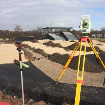
At the beginning of any building or civil engineering project, a Topographical Survey is required to provide a base from which any new build is designed and developed. Increasingly Topographical Surveys are a requirement to obtain the relevant planning consent
Topographical Surveys display accurate representations of existing features within a site boundaries, which are the basis of design for any new works projects.
Our Topographical Surveys accurately record and plot buildings, roads, footpaths, kerblines, overhead cables, fences, trees, planting areas, surface material types, service cover locations etc.

The Topographical Survey will also show contours and detailed level information which will be used in the design of new buildings, new roads and services along with landscaping features.
Our Topographical Surveys can be created based upon O.S National Grid coordinates and O.S levels or to pre established local coordinates.
Surveying raw data is processed by n4ce survey software and final drawings can be issued in paper format and in 2D/3D dxf or dwg or formats.We can also issue our drawings in pdf format which allows digital viewing of the survey drawing without the requirement of a cad software package.
All our survey data is stored on our network to provide a comprehensive library for each survey.