TEL: 07979 812392
Survey Equipment

We use Leica Survey Equipment for all our survey work.
Our instrumentation consists of
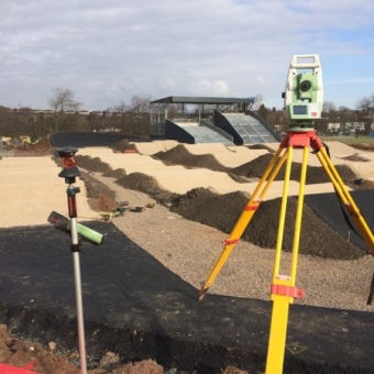
Total Station/Controller – Leica TS 16 with Leica Captivate CS20 controller.This is a 1" robotic motorised total station which can be used in either one or two man surveying mode.
The system also uses reflectorless technology to survey in 3d, inaccessible points
such as building or quarry faces, building ridge locations and levels,
underside of bridges or canopies etc.
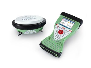
GPS/GNSS - Leica SMARTROVER which is a one man GPS/GNSS unit, working in real time OS coordinates and levels.
The unit receives corrections via the LEICA SMARTNET RTK network.

Survey Software - We use n4ce professional survey software from Applications In Cadd Ltd for all our survey data processing work.
All survey data processing,volume calculations, cad work, 3d visualisation work, cross sections, river sections and drawing work is produced with n4ce survey software