TEL: 07979 812392
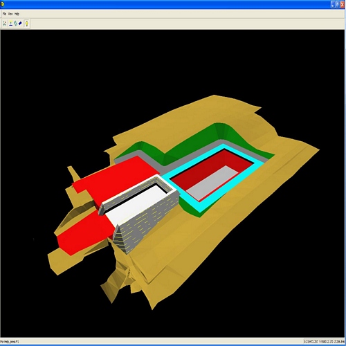
3D View of Proposed Farm Works

The above is a screenshot from n4ce survey software. In this instance, an initial Topographical Survey was carried out, and using that as a base, a proposed silage pit, slurry pit and access track were designed. The 3D design levels were input into the software to allow cut/fill volume calculations to be carried out. Cut and fill quantities were separated between silage pit, slurry pit, access road and embankments. The 3D view can be shown from all viewpoints to the client to display a better understanding of the proposed completed works.


